PinnedPublished inTDS ArchiveGenerate a 3D Mesh from an Image with PythonCombine Deep Learning with 3D data processing to generate a meshOct 26, 20227Oct 26, 20227
PinnedPublished inTDS ArchiveThe Ultimate Beginner’s Guide to Geospatial Raster DataEverything you need to know about raster files, georeferencing, metadata and Rasterio Python libraryOct 13, 20224Oct 13, 20224
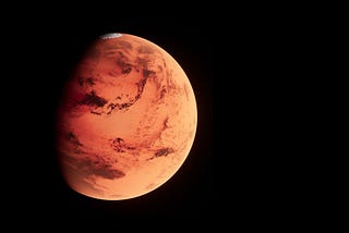
Published inTDS ArchiveMonocular Depth Estimation to Predict Surface Reliefs of MarsA different application of monocular depth estimation modelsSep 4, 2023Sep 4, 2023
Published inTDS ArchiveGenerate a 3D Mesh of a Geographic AreaFrom a digital elevation model to a 3D meshMar 14, 20231Mar 14, 20231
Published inTDS ArchiveBuild a Segmentation Model with One Line of CodeBuild and train a neural network model for image segmentation in the fastest wayMar 6, 2023Mar 6, 2023
Published inTDS ArchiveWhat Is a Satellite Image Time Series?A foundation for current and future global challengesMar 2, 20231Mar 2, 20231
Published inLevel Up CodingHow to split an Image into Patches with PythonSplit an image into parts of equal size with this Python librarySep 6, 20222Sep 6, 20222
Published inTowards AIHow to use TorchMetricsA guide for using TorchMetrics with PyTorch or PyTorch LightningAug 30, 20221Aug 30, 20221
Generate a 3D Mesh from a Point Cloud with PythonThe fastest way to generate a 3D mesh from a point cloudAug 20, 20223Aug 20, 20223